![](/images/other/stat-length.png)
![Tocht Te voet Palazzuolo sul Senio - IT-607A - Photo](https://media.geolcdn.com/t/1900/400/cb85535f-afff-433b-a0eb-9af819252ed5.jpeg&format=pjpeg&maxdim=2)
IT-607A
SityTrail - itinéraires balisés pédestres
Tous les sentiers balisés d’Europe GUIDE+
![Lengte](/images/other/stat-length.png)
Lengte
4 km
![Max. hoogte](https://static1.geolcdn.com/siteimages/upload/files/1508320355ic_sort_altitude_max_24dp.png)
Max. hoogte
1017 m
![Positief hoogteverschil](https://static1.geolcdn.com/siteimages/upload/files/1508320355ic_sort_den_pos_24dp.png)
Positief hoogteverschil
6 m
![Km-Effort](/images/other/stat-length.png)
Km-Effort
5,8 km
![Min. hoogte](https://static1.geolcdn.com/siteimages/upload/files/1508320355ic_sort_altitude_min_24dp.png)
Min. hoogte
485 m
![Negatief hoogteverschil](https://static1.geolcdn.com/siteimages/upload/files/1508320355ic_sort_den_neg_24dp.png)
Negatief hoogteverschil
526 m
![Boucle](https://static1.geolcdn.com/siteimages/upload/files/16400158638029165_repeat_loop_refresh_sync_direction_icon.png)
Boucle
Neen
Markering
Datum van aanmaak :
2022-02-15 14:46:01.75
Laatste wijziging :
2022-03-01 15:06:26.05
![Te voet](https://static1.geolcdn.com/sitytour/trail-icons/100.png)
1h18
Moeilijkheid : Gemakkelijk
![Scan deze QR-code om de tocht te openen in de SityTrail-applicatie](https://capi.geolives.com/qq0zvz2zws4bq2lad0pu/sitytour/trails/3120263/qr.png?size=200)
Gratisgps-wandelapplicatie
Over ons
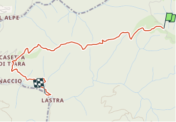
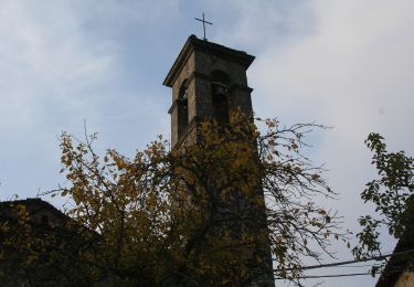
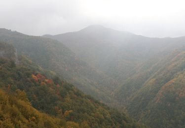
Tocht Te voet van 4 km beschikbaar op Toscane, Firenze, Palazzuolo sul Senio. Deze tocht wordt voorgesteld door SityTrail - itinéraires balisés pédestres.
Beschrijving
Trail created by CAI Imola.
Relation maintened by Gabriele Sani (CAI-FA)
Symbol: 607A on white red flag
Website: http://www.cai-imola.it/
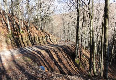
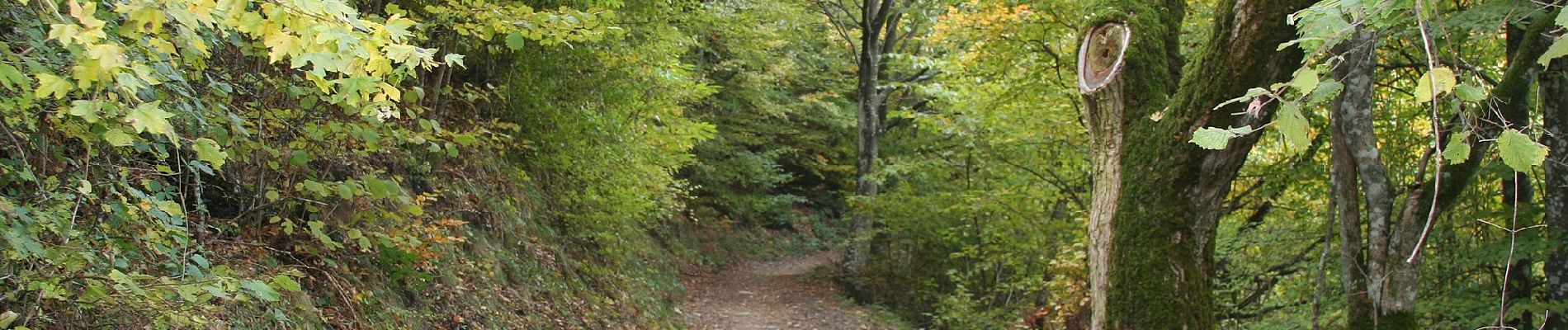
Plaatsbepaling
Land:
Italy
Regio :
Toscane
Departement/Provincie :
Firenze
Gemeente :
Palazzuolo sul Senio
Locatie:
Unknown
Vertrek:(Dec)
Vertrek:(UTM)
697402 ; 4885870 (32T) N.
Opmerkingen
Wandeltochten in de omgeving
![Tocht Te voet Firenzuola - Sorgenti di Firenze Trekking - Anello 15: Sui monti di Moscheta - Photo](https://media.geolcdn.com/t/375/260/933cc0d5-e5eb-4971-b1fe-de6532420af3.jpeg&format=jpg&maxdim=2)
![Te voet Te voet](https://static1.geolcdn.com/sitytour/trail-icons/100.png)
Sorgenti di Firenze Trekking - Anello 15: Sui monti di Moscheta
Te voet
Gemakkelijk
Firenzuola,
Toscane,
Firenze,
Italy
![](/images/other/stat-length.png)
10 km | 16,2 km-effort
3h 40min
![](https://static1.geolcdn.com/siteimages/upload/files/16400158638029165_repeat_loop_refresh_sync_direction_icon.png)
Neen
![Tocht Te voet Firenzuola - Sorgenti di Firenze Trekking – Anello Principale: Tappa 1 - Photo](https://media.geolcdn.com/t/375/260/484a73ee-a64f-4bc5-b576-0dd44087b5af.jpeg&format=jpg&maxdim=2)
![Te voet Te voet](https://static1.geolcdn.com/sitytour/trail-icons/100.png)
Sorgenti di Firenze Trekking – Anello Principale: Tappa 1
Te voet
Moeilijk
Firenzuola,
Toscane,
Firenze,
Italy
![](/images/other/stat-length.png)
19 km | 32 km-effort
7h 20min
![](https://static1.geolcdn.com/siteimages/upload/files/16400158638029165_repeat_loop_refresh_sync_direction_icon.png)
Neen
![Tocht Te voet Palazzuolo sul Senio - IT-90 - Photo](https://media.geolcdn.com/t/375/260/e6d9b4f7-20a3-4d4c-8b76-6c05baf8ccee.jpeg&format=jpg&maxdim=2)
![Te voet Te voet](https://static1.geolcdn.com/sitytour/trail-icons/100.png)
IT-90
Te voet
Gemakkelijk
Palazzuolo sul Senio,
Toscane,
Firenze,
Italy
![](/images/other/stat-length.png)
9,4 km | 15,4 km-effort
3h 29min
![](https://static1.geolcdn.com/siteimages/upload/files/16400158638029165_repeat_loop_refresh_sync_direction_icon.png)
Neen
![Tocht Te voet Palazzuolo sul Senio - IT-41 - Photo](https://media.geolcdn.com/t/375/260/6a638721-55c1-4f6d-8245-b9d584d98964.jpeg&format=jpg&maxdim=2)
![Te voet Te voet](https://static1.geolcdn.com/sitytour/trail-icons/100.png)
IT-41
Te voet
Gemakkelijk
Palazzuolo sul Senio,
Toscane,
Firenze,
Italy
![](/images/other/stat-length.png)
6,8 km | 12,2 km-effort
2h 46min
![](https://static1.geolcdn.com/siteimages/upload/files/16400158638029165_repeat_loop_refresh_sync_direction_icon.png)
Neen
![Tocht Te voet Palazzuolo sul Senio - IT-581 - Photo](https://media.geolcdn.com/t/375/260/71356f92-0b1b-4feb-9dcf-edda0968194b.jpeg&format=jpg&maxdim=2)
![Te voet Te voet](https://static1.geolcdn.com/sitytour/trail-icons/100.png)
IT-581
Te voet
Gemakkelijk
Palazzuolo sul Senio,
Toscane,
Firenze,
Italy
![](/images/other/stat-length.png)
3,3 km | 5,5 km-effort
1h 15min
![](https://static1.geolcdn.com/siteimages/upload/files/16400158638029165_repeat_loop_refresh_sync_direction_icon.png)
Neen
![Tocht Te voet Palazzuolo sul Senio - IT-741 - Photo](https://media.geolcdn.com/t/375/260/8ec91149-73e4-4168-9bc3-821e058f9a3b.jpeg&format=jpg&maxdim=2)
![Te voet Te voet](https://static1.geolcdn.com/sitytour/trail-icons/100.png)
IT-741
Te voet
Gemakkelijk
Palazzuolo sul Senio,
Toscane,
Firenze,
Italy
![](/images/other/stat-length.png)
7,7 km | 13,6 km-effort
3h 5min
![](https://static1.geolcdn.com/siteimages/upload/files/16400158638029165_repeat_loop_refresh_sync_direction_icon.png)
Ja
![Tocht Te voet Palazzuolo sul Senio - IT-711 - Photo](https://media.geolcdn.com/t/375/260/278fdf13-3a3e-41ef-a779-fea8db6fbb36.jpeg&format=jpg&maxdim=2)
![Te voet Te voet](https://static1.geolcdn.com/sitytour/trail-icons/100.png)
IT-711
Te voet
Gemakkelijk
Palazzuolo sul Senio,
Toscane,
Firenze,
Italy
![](/images/other/stat-length.png)
3,1 km | 4,8 km-effort
1h 5min
![](https://static1.geolcdn.com/siteimages/upload/files/16400158638029165_repeat_loop_refresh_sync_direction_icon.png)
Neen
![Tocht Te voet Firenzuola - IT-713 - Photo](https://media.geolcdn.com/t/375/260/2c890dd7-6d2b-4541-90b2-c6f0209da9ee.jpeg&format=jpg&maxdim=2)
![Te voet Te voet](https://static1.geolcdn.com/sitytour/trail-icons/100.png)
![Tocht Te voet Palazzuolo sul Senio - Anello di Campanara - Photo](https://media.geolcdn.com/t/375/260/88b3933a-0b25-473f-92c1-9d5ce278b334.jpeg&format=jpg&maxdim=2)
![Te voet Te voet](https://static1.geolcdn.com/sitytour/trail-icons/100.png)
Anello di Campanara
Te voet
Medium
Palazzuolo sul Senio,
Toscane,
Firenze,
Italy
![](/images/other/stat-length.png)
15,6 km | 26 km-effort
5h 50min
![](https://static1.geolcdn.com/siteimages/upload/files/16400158638029165_repeat_loop_refresh_sync_direction_icon.png)
Ja